- When
- Where
- Coon Den Falls
Hampton, TN 37658, United States
Directions to parking - Trail
- Coon Den Falls Trail · Out and back · 1.3 mi · 400 ft of climbing
- Meet at
- Drive past the Appalachian Trail trailhead toward Dennis Cove Campground. Just before the entrance there is a gravel parking lot. We will meet near the guard railing.
- Parking
- Park anywhere in the gravel lot.
- Price
- $30
- Ages
- 13 and up (under 18 must come with an adult in their sign-up)
- Spots
- 10 of 10 spots left
Coon Den FallsParkingTrail
Trail at a Glance
- Location
- The trailhead is near Dennis Cove Campground.
- Route
- The route is easy to follow with good signage. The main stream crossing is easy to cross without needing to get in the water.
- Terrain
- The terrain is uneven with loose rock along the trail. There is exposed rock slabs in some points along the trail that can be slick.
- Water
- The trail follows the stream toward the falls. One stream crossing and seasonal springs cross the trail.
- Seasonal considerations
- In cold or freezing temperatures the water crossing the trail can freeze. Sheets of ice are common in colder weather.
What to bring
Half Day Hike @ Coon Den Falls – November 6, 2026, 12:00 pm – 3:00 pm
Tick items off as you pack. Your ticks are saved on this device.
Required
Recommended
Optional
The Trail at a Glance
| Category | Information |
|---|---|
| Distance | 1.48 miles |
| Route Type | Out-and-Back or Loop |
| Elevation Gain | 545 ft |
| Elevation Loss | 545 ft |
| Net Elevation Change | 0 ft |
| Highest Elevation | 3,140 ft (mile 0.7) |
| Lowest Elevation | 2,631 ft (mile 1.35) |
| Average Elevation | 2,824 ft |
| Eremos Roughness | 1.25 |
| Estimated Trail Time | 0.5–1.5 hours |
| Water | No recorded sources |
| Shelters | 0 |
| Camping | No recorded sites |
| Biggest Climb | +499 ft over 0.55 mi (miles 0.15–0.7) |
Walking the Trail
Coon Den Falls begins by asking for a little effort. The trail climbs steadily toward the water crossing, then offers a brief respite as it drops down to the stream.
Crossing the water from stone to stone is a small threshold. On the other side, the trail makes its intention clear: the remainder of the walk is uphill. There is little level ground and no gentle slope to settle into. The ascent becomes steeper, and a spring running over bare rock can make the route slick when it is already demanding attention.
The stream stays near the trail, offering something gentle beside the hard work. It asks no less of a hiker, but it does invite a different pace, one careful step, then another.
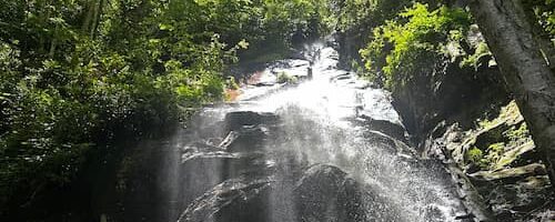
A short reprieve near the upper trail gives way to the final push toward the falls. There, mist hangs in the air and the temperature drops. On hot days, it is a welcome comfort. On cold days, it can be chilling.
The falls are a place to sit close, rest, and let conversation return. Then comes the way back: a descent that requires as much focus as the climb. When the stream crossing is behind you, the trail finally eases, leaving room to enjoy the last stretch toward home.