
Overview
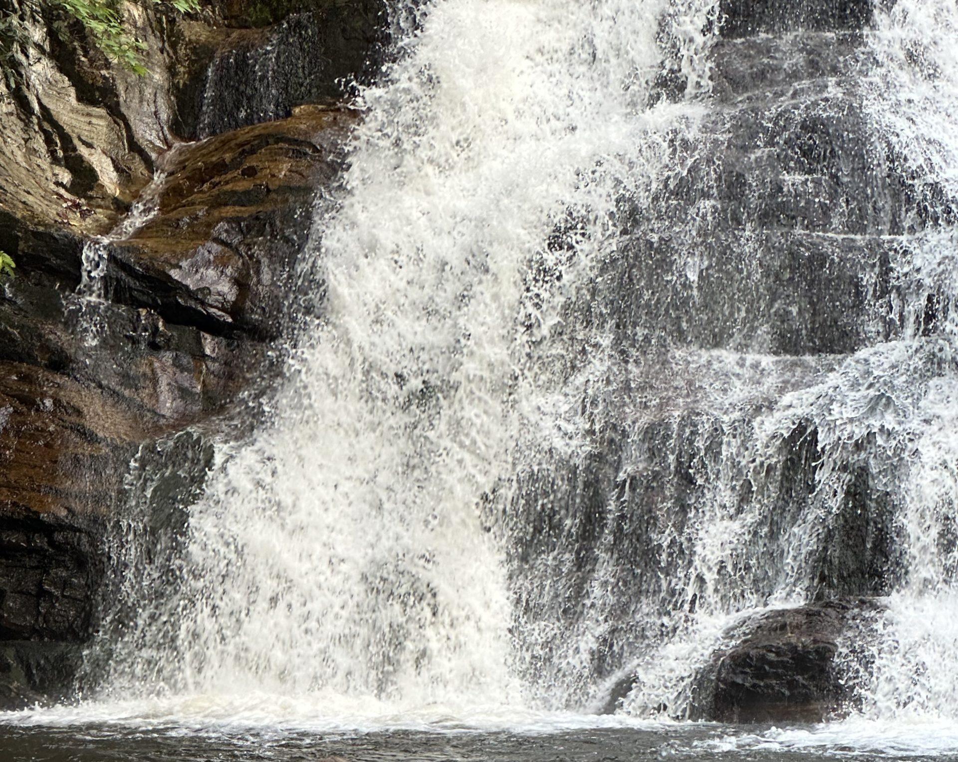
Laurel Falls is a forested mountain waterfall reached by a short route from the Dennis Cove area. The trail begins gently, following an established path through the woods before gradually becoming more demanding as it approaches the falls.
The distance makes this trail approachable for many hikers, but the mileage doesn’t tell the whole story. The route down toward the falls includes more difficult sections, and the return requires climbing back out.
Laurel Falls makes a good destination for a shorter day on the trail, with enough variety in the terrain to make the walk more than simply a trip to a waterfall.
Trail at a Glance
Location: Dennis Cove, Hampton, Tennessee
Route: Dennis Cove to Laurel Falls
Terrain: Forest trail with mostly gentle terrain and several more demanding climbs
Water: Seasonal wet areas and stream conditions may be present
Seasonal Considerations: Wet and freezing conditions can make the more difficult sections slick and more challenging.
Eremos uses this trail as a starting point for half day, full day, and multi day events.
Half Day
Distance: Approximately 2.7 miles round trip
Estimated Time: Approximately 4 hours
Trail Type: Out-and-back
Difficulty: 0.75/5 (Low Difficulty with some difficult sections)
Elevation: Gradual overall elevation change with steeper sections near the falls
Full Day
Distance: Approximately 5.34 miles round trip
Estimated Time: Approximately 6.5 hours
Trail Type: Out-and-back
Difficulty: 0.75/5 (Low Difficulty with some difficult sections)
Elevation: Gradual overall elevation change with steeper sections near the falls. Steady descent after the falls with some minor climbs.
Backpacking Experience:
Distance: Approximately 9.18 miles
Estimated Time: Approximately 2 Days
Trail Type: Point-to-point
Difficulty: 1/5 (Moderate difficulty)
Elevation: Gradual overall elevation change with steeper sections near the falls. After the Hampton Blue Line crossing the trail turns up steeply.
Key Points
The trail starts gently. The opening portion gives you time to settle into the walk before the terrain becomes more demanding.
The descent to the falls is the harder part of the route. Some sections require more attention and effort than the early portion of the trail suggests.
Remember the return trip. Reaching the waterfall means you’ve completed only part of the hike. The climb back from the falls can be taxing.
Conditions matter. Wet weather can make the trail more difficult, particularly on steeper or uneven sections. Cold weather can introduce additional hazards.
The mileage can be misleading. At roughly 2.7 miles round trip for the half day hike, this is not a long hike, but it still provides enough terrain variation to require thoughtful pacing. Adding in the additional miles for the full day helps slow the pace when needed.
Walking the Trail
The route begins near Dennis Cove and enters the forest on relatively gentle terrain. The early portion of the walk provides an opportunity to settle into a comfortable pace without immediately demanding much effort.
As the trail continues, the character gradually changes. The terrain becomes more varied, with sections that require greater attention and more deliberate footing.
Eventually, the trail descends toward Laurel Falls. The approach to the falls is more demanding than the beginning of the route, and the changing terrain becomes part of the experience rather than simply a means of reaching the destination.
At the falls, there is an opportunity to stop and spend some time before beginning the return journey.
Here is where we deviate from the return for the full day and multi day experiences. The Full day continues to the Hampton Blue Line Trail before returning to the Dennis Cove trailhead. The Backpacking experience turns toward the climb toward Shook Branch.
For the half and full day hikes the way back follows the same route, but the sections that were downhill on the way in now become uphill. For many hikers, this is where the trail feels most demanding.
Before You Go
Wear footwear appropriate for uneven forest terrain and conditions that may become wet or slick. Bring water and weather-appropriate clothing for a few hours in the mountains.
Pace yourself with the return trip in mind. The trail may feel relatively easy at the beginning, but the more demanding sections near the falls will need to be climbed again on the way back.
Weather can significantly affect trail conditions. Check conditions before leaving and be prepared to adjust your plans when wet, icy, or otherwise hazardous conditions are present.
If you’re unfamiliar with Dennis Cove, make sure you know the exact parking and starting location for your route before arriving.
Walk It With Eremos
Eremos occasionally leads guided hikes to Laurel Falls.
A guided experience gives us room to experience the trail together rather than simply checking a waterfall off a list. We walk at a sustainable pace, make room for conversation and silence, and pay attention to what the trail reveals along the way.
Explore Eremos Half-Day Hikes →
Related Resources
Explore Eremos Trail Journals →
Experience the Wilderness
Not sure where to start?
Start simple.
Half-Day Hikes are the most accessible entry into Eremos. From there, each step offers more time, more simplicity, and more space to pay attention to God on the trail.
You don’t need to choose perfectly. You only need to begin.
Eremos is here to help